

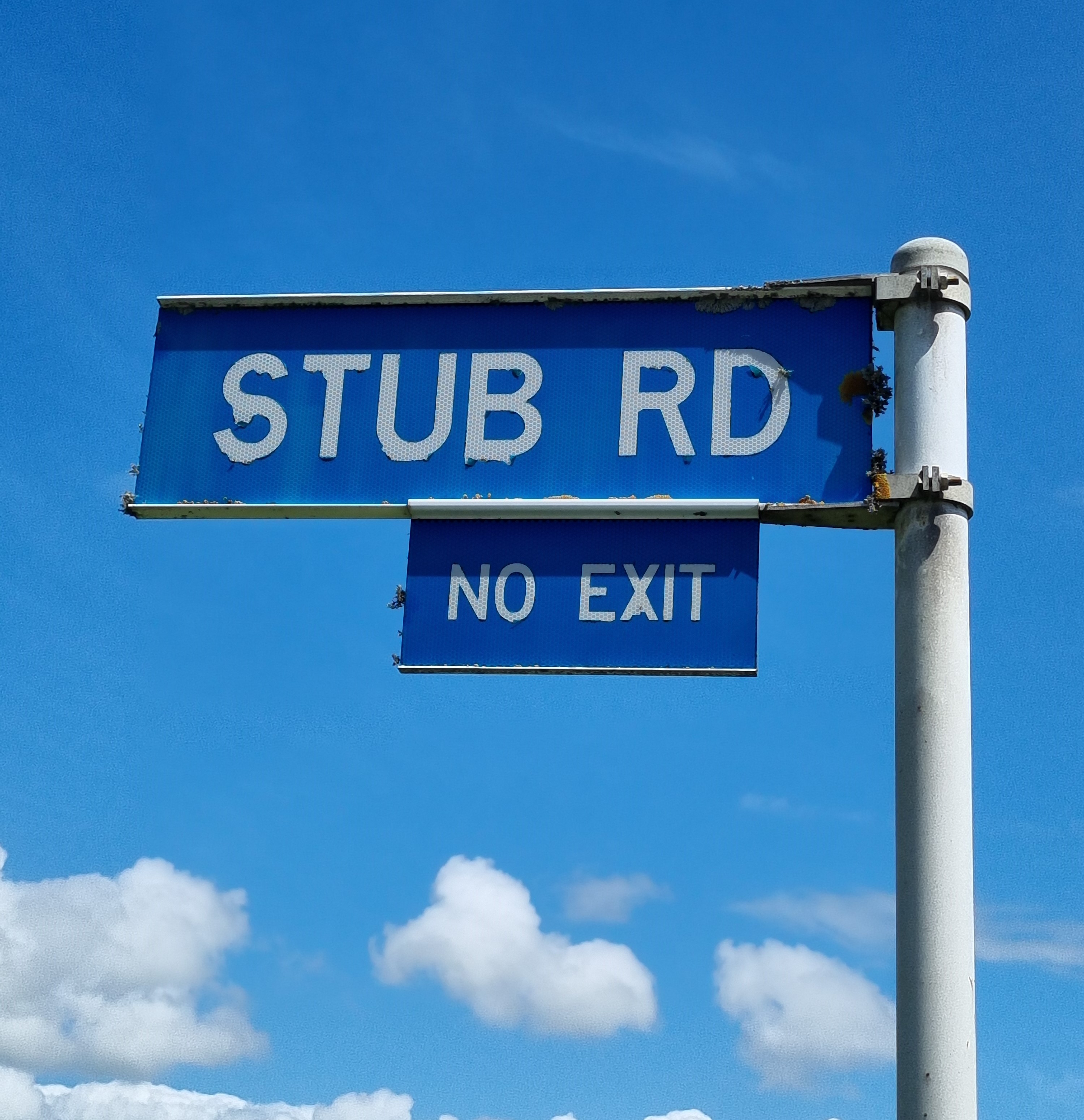
It is easy to miss this small, rather insignificant road, signposted as Stub Road, just off Devon Road in Waiwhakahio, in this busy industrial section of New Plymouth.
The term, stub, doesn’t refer to a local landmark or personality but is a surveying reference to its purpose: a dead-end road, meaning a road terminated at a boundary line. In this case, it is an apt description for the short road that leads nowhere but behind some industrial buildings and terminates at the Mangaone Stream and its flood protection walls.
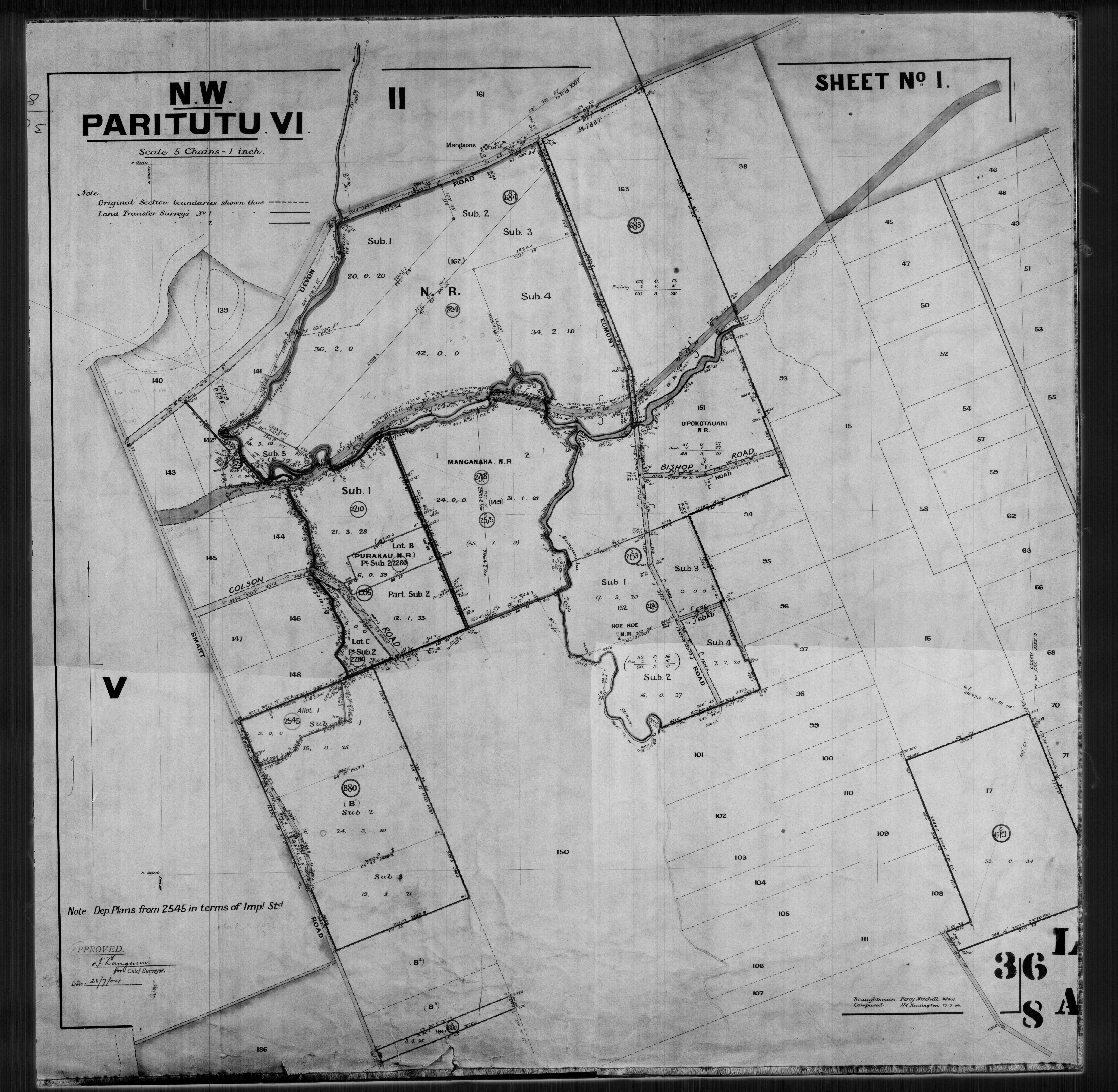
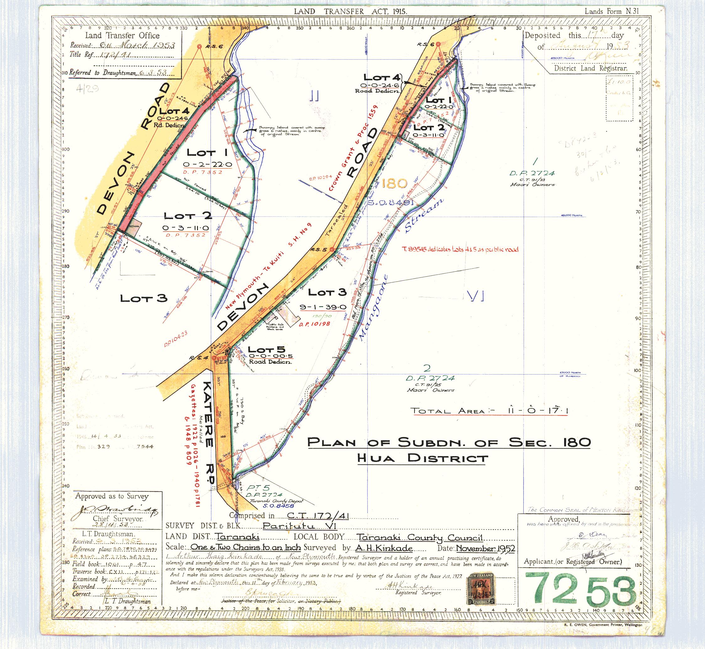
Stub Road first appears on maps from 1971 when the area around it was being subdivided. It sits within the Katere or Waiwhakaio Native Reserve - which is part of the rohe of Te Atiawa hapu, Ngāti Tāwhirikura. The reserve was one of 17 reserves made when the Crown acquired the Waiwakaiho block in 1853.
In 1887 the reserve was vested in its Māori owners by the Native Land Court. Later, some of this land was acquired through the Public Works Act for railway and roading purposes and some was declared Crown Land, while some was sold to businesses.
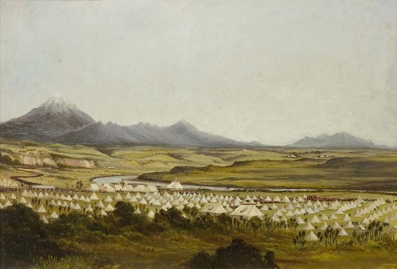
Current day Stub Road sits close to the site of several former pā which existed in the area, including Pararoa Pā, Paraparaiti Pā and Mangaone Pā. Little remains of many of these pā and other sites of cultural significance due to the continued growth of this industrial area.
In the 1970s the area around Stub Road, towards the Waiwhakaio River, now known as The Valley, was ear marked for industrial development. The area had already been the site of the Waiwhakaiho Showgrounds from the late 1800s and then used as a speedway from the 1950s.
The Katere Scenic Reserve can be seen from Stub Road and runs like a strip of green on the inland side of the Mangaone stream, from Katere Road to Devon Road.
The Mangaone stream itself forms an important part of the on-going flood protection of the area, which includes floodwalls and stop banks on this stream and the Waiwhakaiho River, as well as rock linings and floodgates. The Taranaki Regional Council developed the flood defences first in the 1990s, upgraded them in 2013 and further improved them last year.
Contributed by the Taranaki Research Centre I Te Pua Wānanga o Taranaki at Puke Ariki. Find this and hundreds of other street histories on NPDC’s Puke Ariki website: https://terangiaoaonunui.pukeariki.com/story-collections/word-on-the-street
Documents and Maps
SO682 Cadastral Plan Index (Imaged by LINZ)
SO68 Cadastral Plan Index (Imaged by LINZ)
SO36-8A Cadastral Plan Index (Imaged by LINZ)
DP7253 Cadastral Plan Index (Imaged by LINZ)
DP10423 Cadastral Plan Index (Imaged by LINZ)
Books
Research of Wahitapu sites and land title history of the Waiwakaiho or Katere Native Reserve, Leanne Boulton (1995)
A Report Commissioned by the Waitangi Tribunal for the Taranaki Claim (Wai 143) Concerning Ngāmotu (Katere Reserve), Suzanne Woodley (1995)
Please do not reproduce these images without permission from Puke Ariki.
Contact us for more information or you can order images online here.


