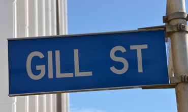
Scott Street sign (2020). Mike Gooch. Word on the street image collection.
Scott Street sign (2020). Mike Gooch. Word on the street image collection.
Scott Street sign (2020). Mike Gooch. Word on the street image collection.
Scott Street lies on the southern slopes of Mount Moturoa and winds its way to the lookout at the summit, which provides panoramic views of New Plymouth.
Plans for the development of this area date back as far as 1919. But our first recorded instance of the new subdivision named Port View appears as an insert on a 1931 Lands and Survey cadastral map.
It seems likely that the planned subdivision was a result of ambitious expansion plans for the port. In 1918 the new port engineer, J. Blair Mason, outlined a proposal to build new wharves, a seawall from Moturoa Island and an eight hundred foot extension to the breakwater. As it turned out, much of the port development languished on paper, as did the Port View subdivision.
The man behind the plans for Port View was Robert Scott, who was born in South Canterbury in 1867. Scott moved to the Hawkes Bay in his teens, where he became well known as a champion blade shearer. Robert married Kate Catherine Fahey and in 1907 the family moved to Taranaki. He bought land at Ōhura and Ahitītī and was a key figure in the formation of the Okau Co-operative Dairy Co. Ltd.
The Scott's next move was to Moturoa, and a farm on Breakwater Road. This would, in time, become home to the Port View subdivision. In New Plymouth, Scott developed a reputation as a shrewd businessman and for many years was a director of Devon Finance Company.
Scott died in 1953, before work finally began on the Port View subdivision, in response to New Plymouth's need for more residential land. In 1956 the New Plymouth City Council accepted his daughter's request to use street names from the original plans, including, of course, the name Scott.
This story was originally published in the Taranaki Daily News.
Please do not reproduce these images without permission from Puke Ariki.
Contact us for more information or you can order images online here.
The information on this website is provided for general research and reference only. While we try to keep content accurate and current, we make no guarantees about its completeness or correctness. It should not be considered a replacement for a LIM or a Property Report. Some content is supplied by third parties. Puke Ariki has not verified this content and users should check its accuracy before relying on it.The inclusion of a building on the website does not imply heritage status. See SCHED1 in the NPDC District Plan for a list of buildings that have rules about what can happen to or around them (administered by NPDC). See the New Zealand Heritage List for a list of buildings that are celebrated for their heritage significance but are not subject to rules (administered by Heritage New Zealand Pouhere Taonga). Should any corrections need to be made to the records or for more information please contact us.