


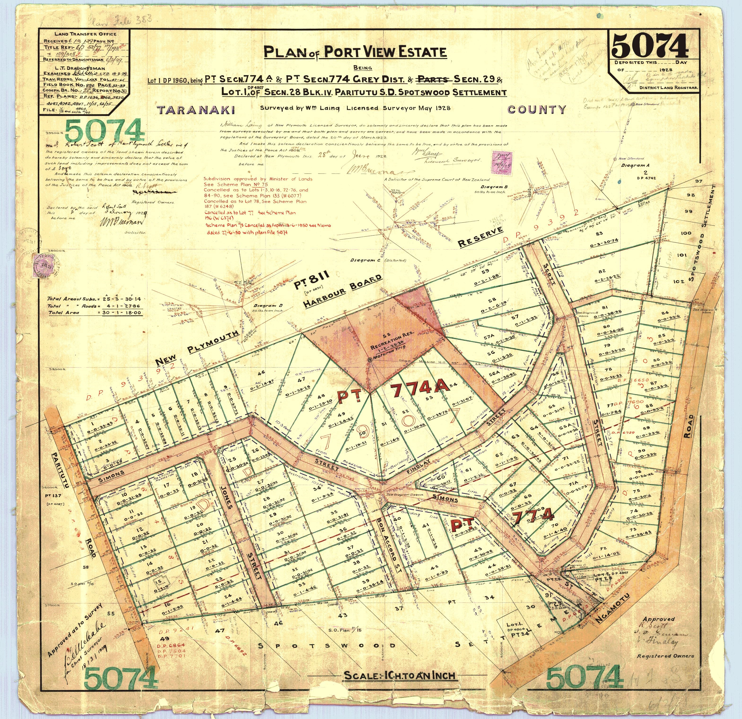
Plans for the development of this part of Moturoa, close to the port, date back to the 1920s. The new subdivision was to be known as Port View, although that was not a name given to any of the proposed roads.
The subdivision was a result of ambitious expansion plans for the port at the time. However, growth was slower than anticipated and it would be nearly 40 years, in the mid-1950s, before work finally began on the Port View subdivision. Even then, Port View, was not one of the street names selected; rather they were Scott, Findlay and Simons.
The road was finally surveyed in 1962, when it was merely identified as "Future Road". A more detailed survey was carried out in 1964, and this time the name Port View Crescent was used. The name was recommended by the Taranaki Harbours Board, who then owned the land, for the simple reason that the new road looked out over their busy port.
Port View Crescent runs from Centennial Drive to Paritutu Road along the western slopes of Mt Moturoa, now also known as Papawhero. The land on either side of the road stayed in the ownership of the Harbours Board and is now held by the Taranaki Regional Council on 99-year leases, with rent reviews every seven years.
It is a predominantly industrial area, and while development was slow to take off, construction of the New Plymouth Power Station in the early 1970s created a demand for commercial premises.
Although the power station has been decommissioned and mostly demolished, the port ensures a continued demand for industrial property in the local area.
This story was originally published in the Taranaki Daily News.
Please do not reproduce these images without permission from Puke Ariki.
Contact us for more information or you can order images online here.
The information on this website is provided for general research and reference only. While we try to keep content accurate and current, we make no guarantees about its completeness or correctness. It should not be considered a replacement for a LIM or a Property Report. Some content is supplied by third parties. Puke Ariki has not verified this content and users should check its accuracy before relying on it.The inclusion of a building on the website does not imply heritage status. See SCHED1 in the NPDC District Plan for a list of buildings that have rules about what can happen to or around them (administered by NPDC). See the New Zealand Heritage List for a list of buildings that are celebrated for their heritage significance but are not subject to rules (administered by Heritage New Zealand Pouhere Taonga). Should any corrections need to be made to the records or for more information please contact us.


