

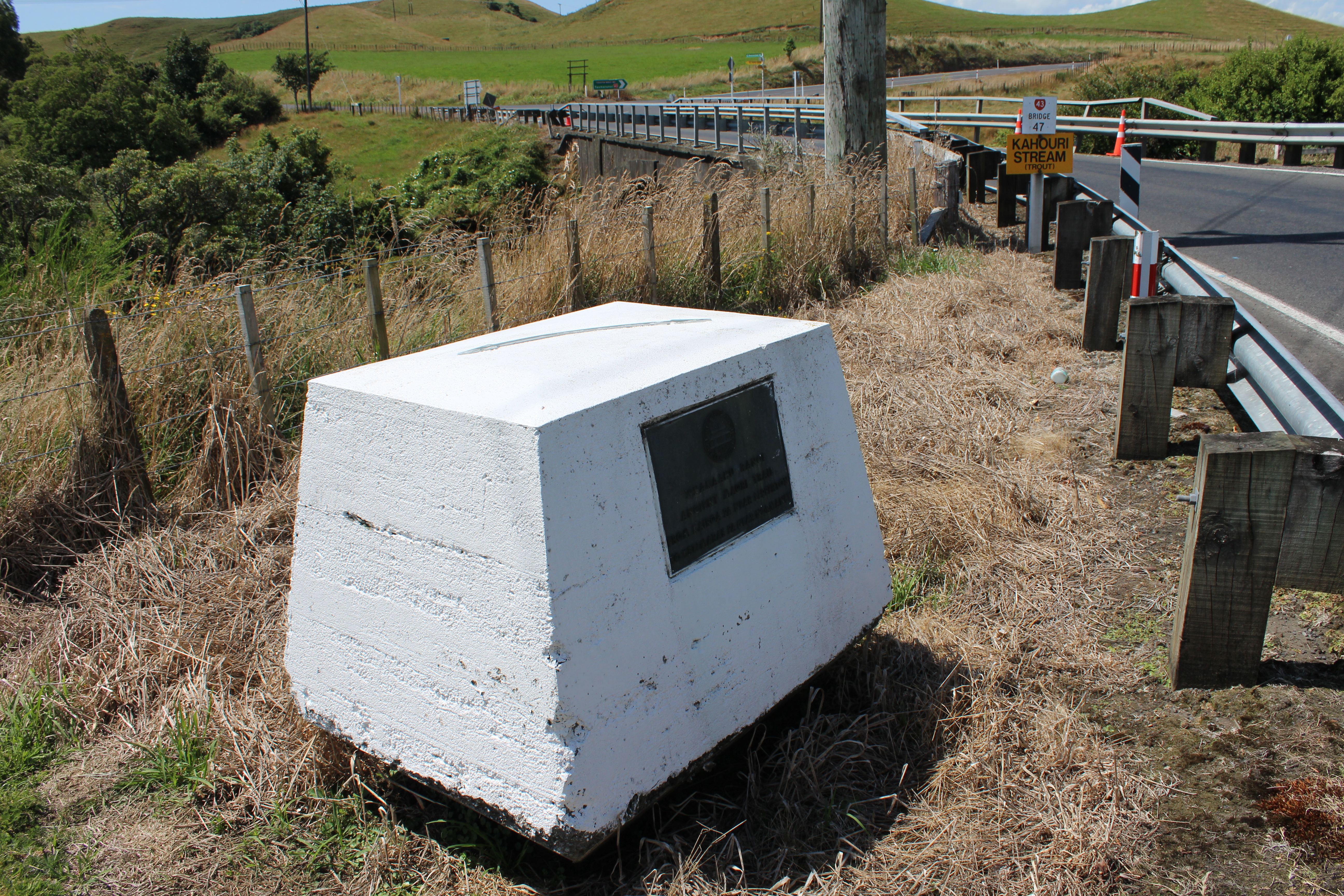
The Whakaahurangi Trail Plaque is located next to Kahouri Bridge near Kopuatama Cemetery, East Road, Stratford.
The NZ Historic Places Trust plaque marks the Whakaahurangi trail which crossed here. The trail was the major route from north to south Taranaki for many hundreds of years.
The name is derived from a journey made by a woman, Ruaputahanga, as she made her way back to her people in south Taranaki from Kawhia. Near present day Stratford, she slept looking up at the sky and the trail received it's name - Whakaahu-rangi or "turned towards the sky."
In 1842-43 a bridle path, which followed much of the trail was cut by Māori labourers under the supervision of the Nairn brothers of New Plymouth. One of the parties began at Mataitawa in the north and the second from the south.
The trail marker was unveiled on 21 March 1959.
There were, apparently, some questions regarding the siting of the trail marker and whether the remains at Kahouri Bridge were that of the Whakaahurangi or of the branch track to Ohura.
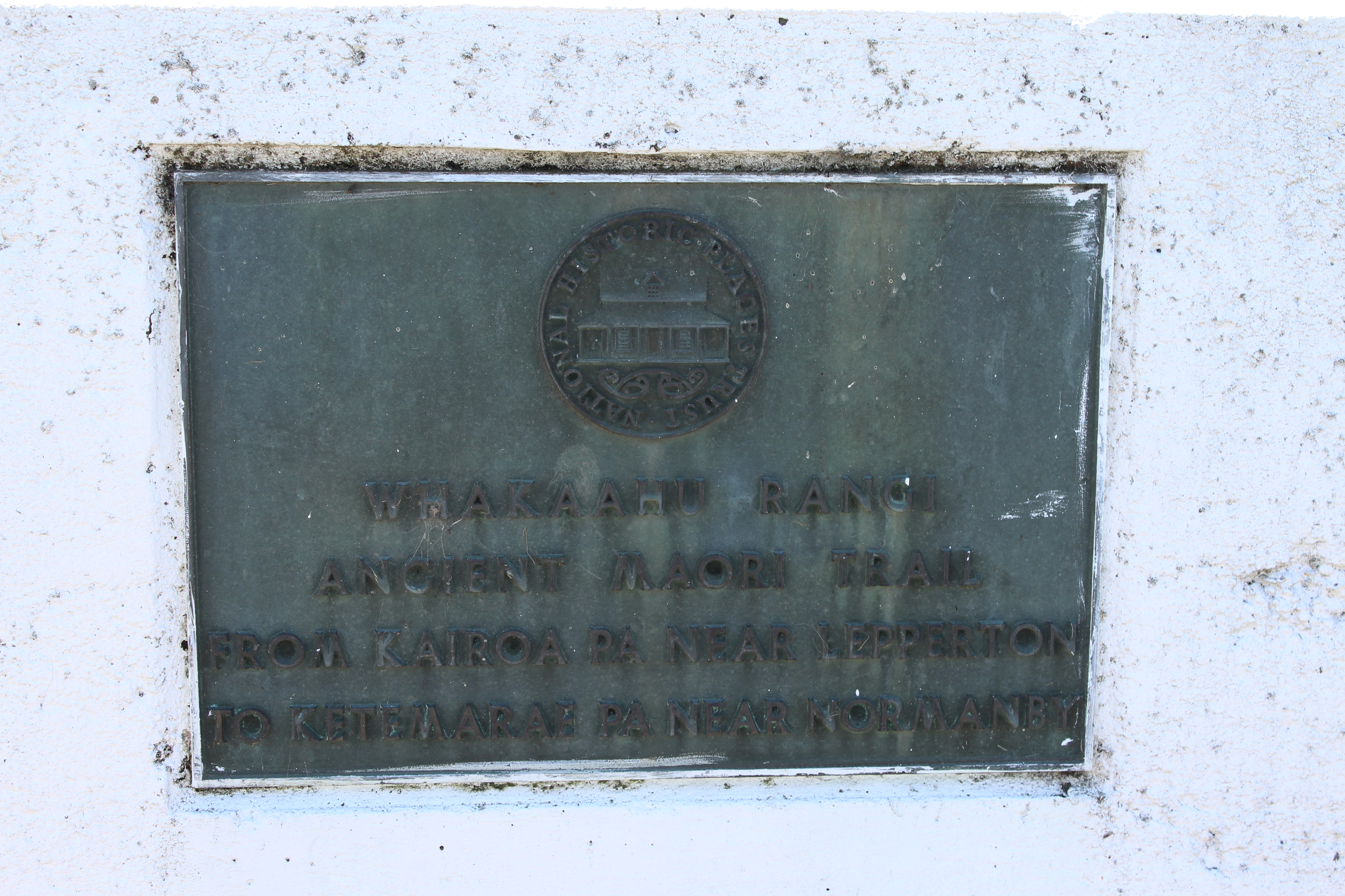
Plaque Inscription
[NZHPT Logo]
WHAKAAHU RANGI
ANCIENT MAORI TRAIL
FROM KAIROA PA NEAR LEPPERTON
TO KETEMARAE PA NEAR NORMANBY
Documents
Plaque marks historic Maori bush trail, Source unknown, undated
Stratford Heritage Register, Stratford District Council
Whakaahurangi Track map, north and south, Taranaki Regional Committee of the National Historic truct Board files, 1959-1960. Collection of Puke Ariki (ARC2019-069
Websites
New Zealand Historic Places Trust, Taranaki branch, Box 1, Ancient Highways, Puke Ariki Collection (ARC2019-067)
Books
Primitive Economics of the New Zealand Maori, Raymond Firth, 1st ed. 1929. Pages 434-437. (TRCM306.3 FIR)
Please do not reproduce these images without permission from Puke Ariki.
Contact us for more information or you can order images online here.


