


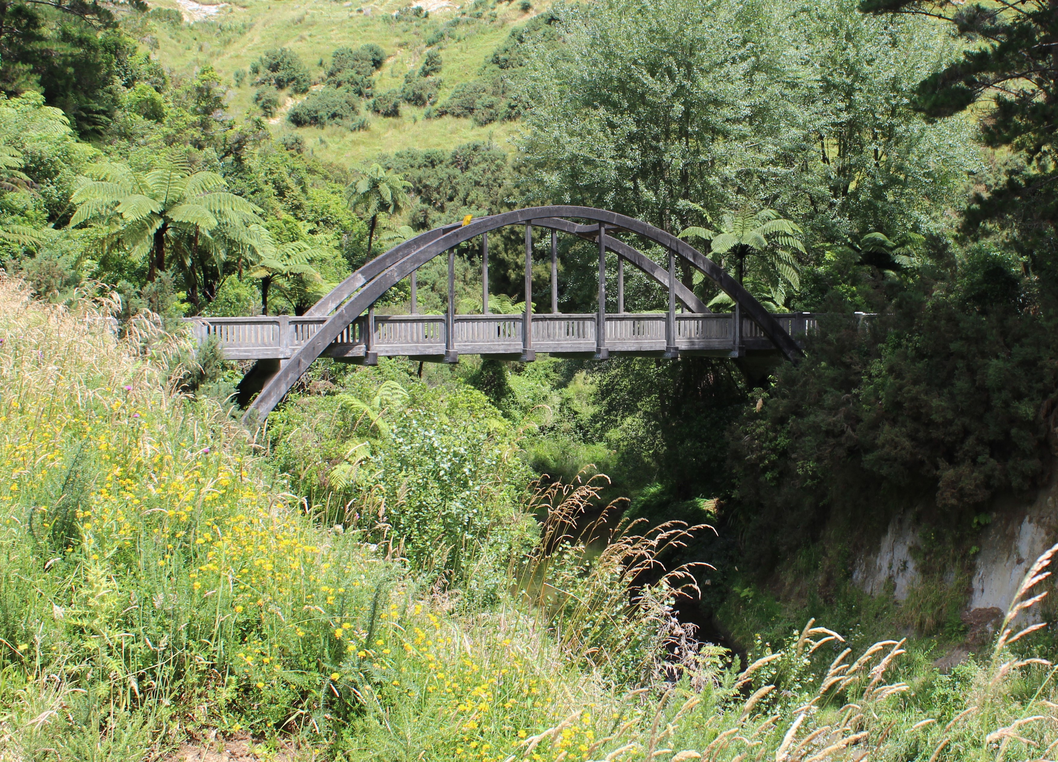
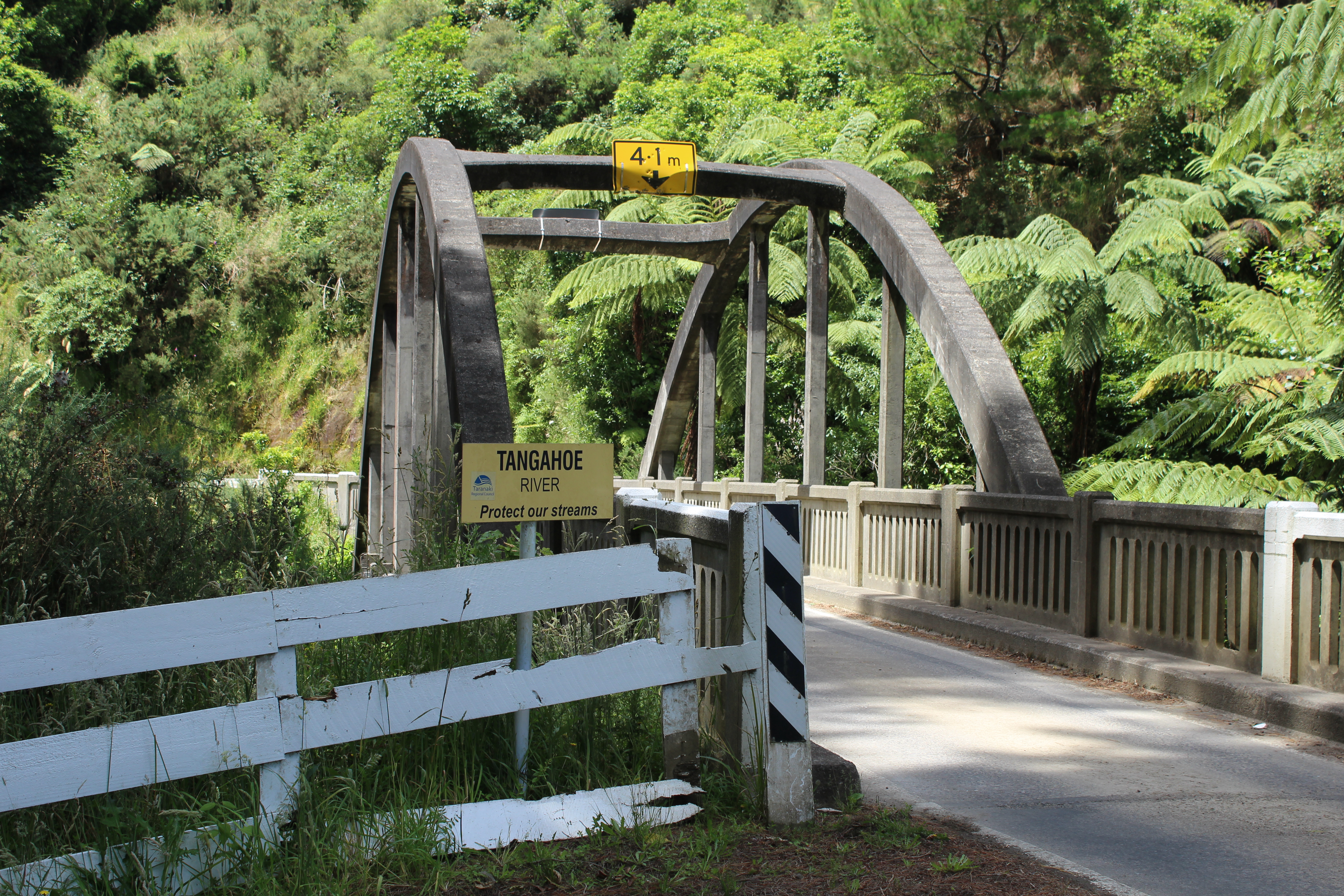
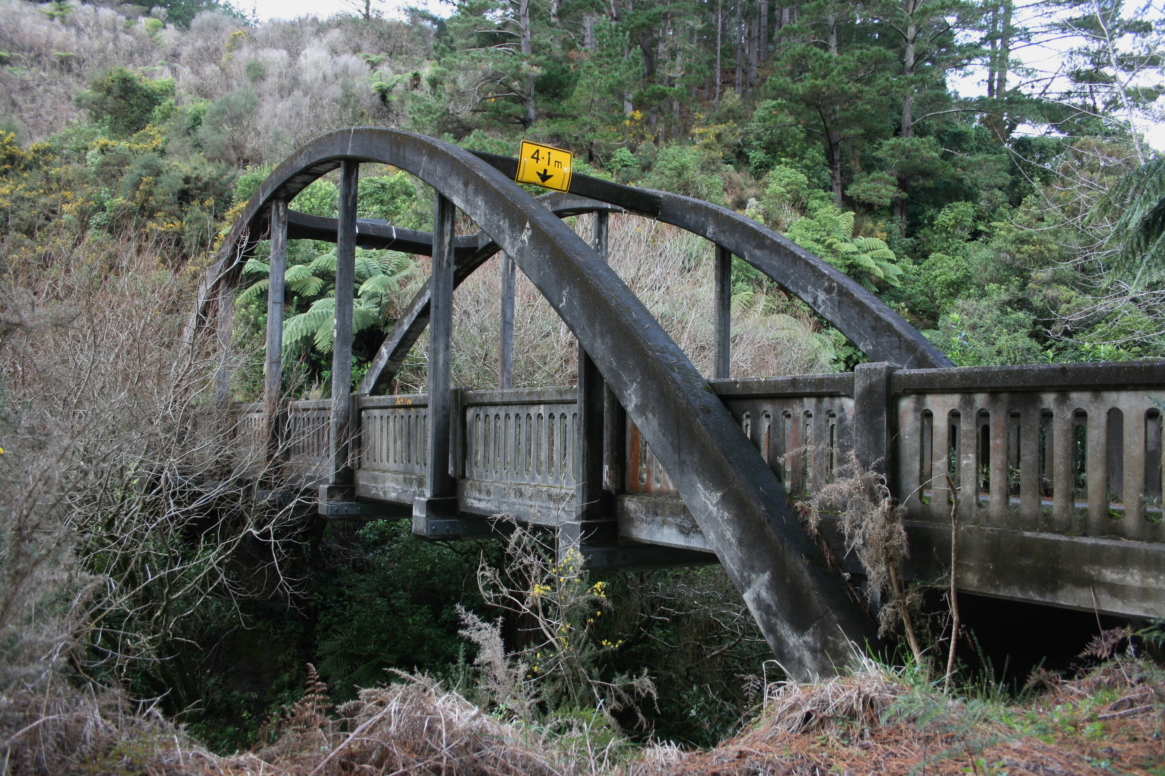
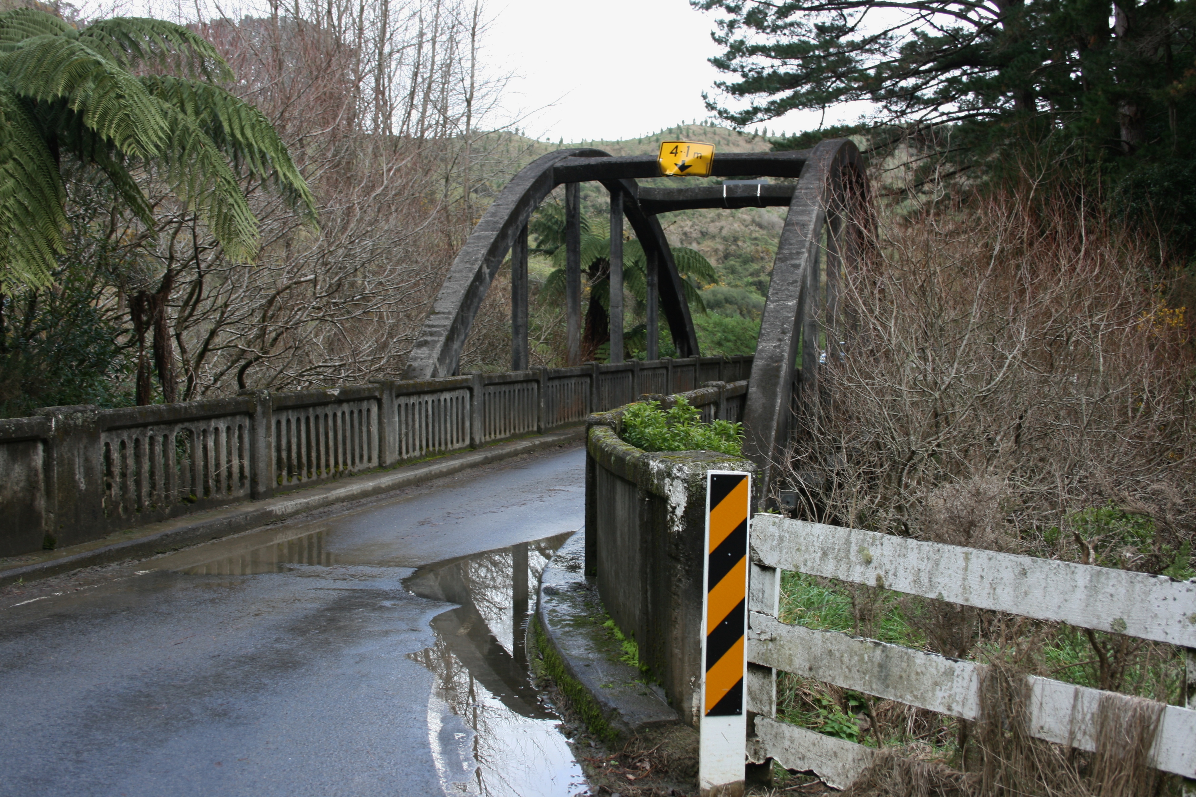
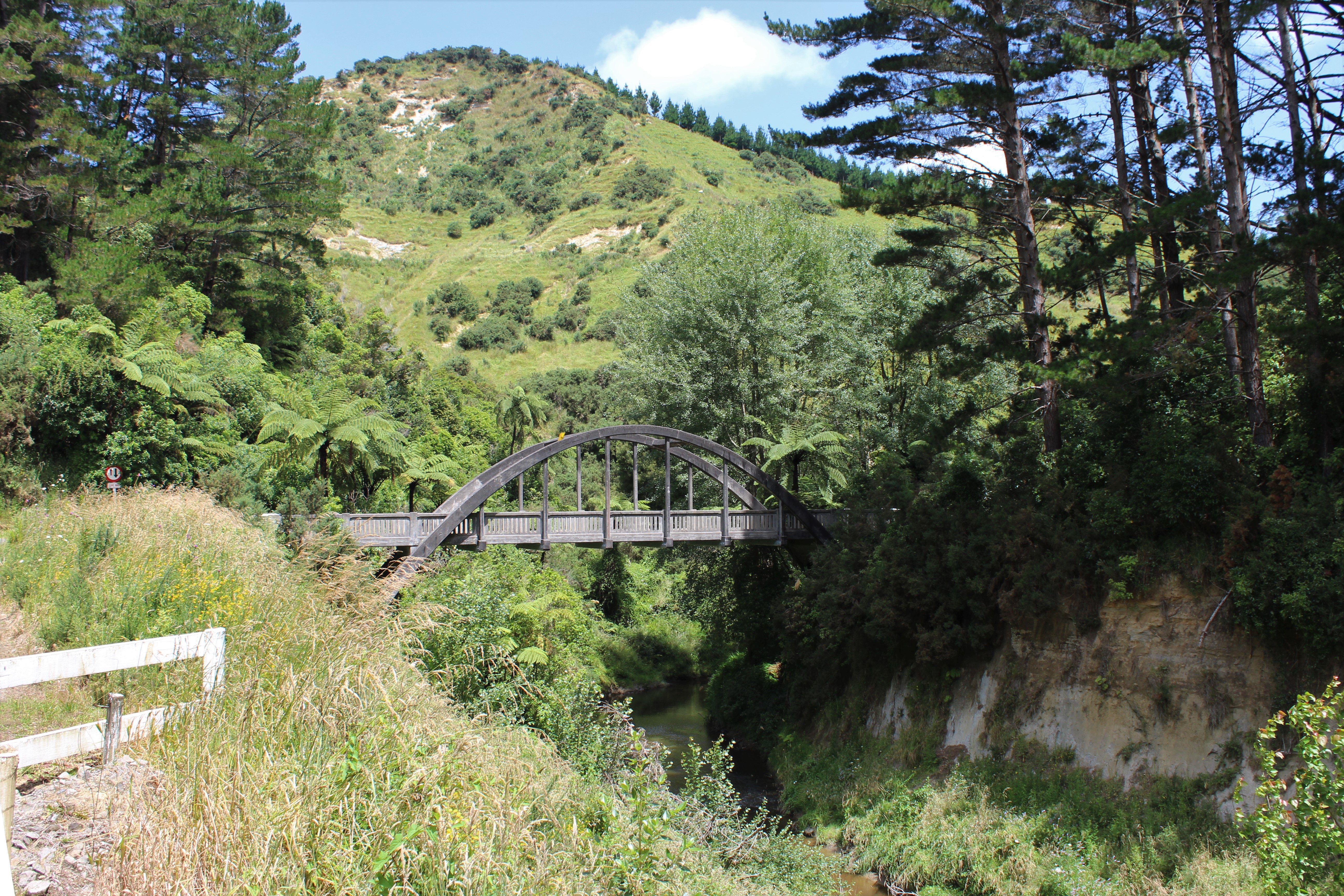
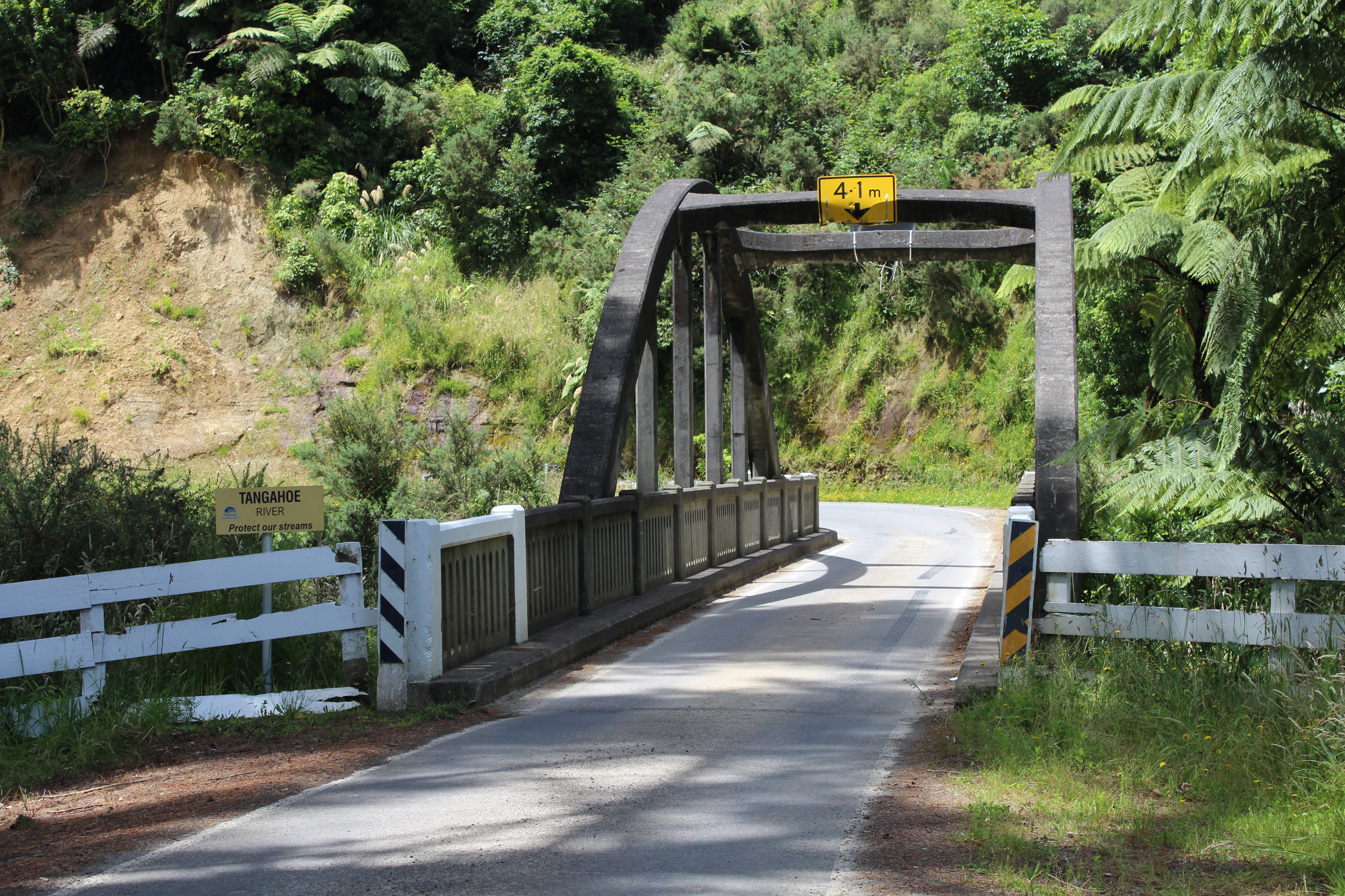
This bridge was built in 1937 over the Tangahoe River on the Tāngahoe Valley Road and replaced an earlier bridge which was destroyed in a flood.
Geoffrey Thornton's book, Bridging the Gap provides more detail on its design; "It has an arch span of 24.2 metres. This is an interesting bridge, the deck passing through the arch about mid-point, with the legs of the arch anchored into the abutments in a visually impressive manner. This is known as a half-through arch. The bridge was designed for the Hawera County Council by the PWD [Public Works Department] to give a 2.4m clearance above the highest recorded flood level." (Thornton, Geoffrey, Bridging the Gap, 2001, p283.)
Please do not reproduce these images without permission from Puke Ariki.
Contact us for more information or you can order images online here.
The information on this website is provided for general research and reference only. While we try to keep content accurate and current, we make no guarantees about its completeness or correctness. It should not be considered a replacement for a LIM or a Property Report. Some content is supplied by third parties. Puke Ariki has not verified this content and users should check its accuracy before relying on it.The inclusion of a building on the website does not imply heritage status. See SCHED1 in the NPDC District Plan for a list of buildings that have rules about what can happen to or around them (administered by NPDC). See the New Zealand Heritage List for a list of buildings that are celebrated for their heritage significance but are not subject to rules (administered by Heritage New Zealand Pouhere Taonga). Should any corrections need to be made to the records or for more information please contact us.


