


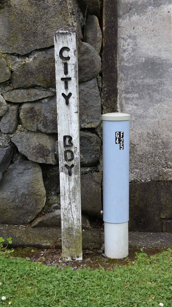
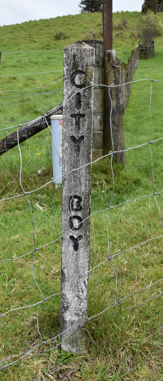
These two boundary markers are located on both sides of Tukapa Street between numbers 345 and 347 (east-side).
It's likely they were placed here in 1960 when Hurdon was added to the New Plymouth City environs and these markers indicate the location where administration changed to what was then known as the Taranaki County Council.
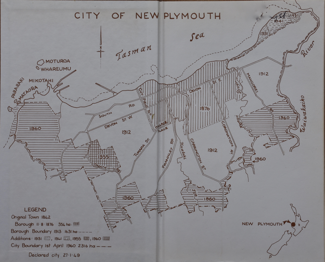
New Plymouth was constituted a borough in 1876 after 24 years of Provincial Government. The boundaries of the first borough were quite tight - Cutfield Road in the west to the Hēnui River in the east and not much further south than what is now Brooklands Park. As time went on and the town grew other areas where added; the first major change being the inclusion of Fitzroy, Vogeltown, Frankleigh Park, Westown and Moturoa/St Aubyn in 1912-13.
The following years saw the addition of some coastal land and a small parcel of land near Omata Road. In 1960 the rapidly growing suburb of Spotswood became part of what was now New Plymouth City (1949) along with Hurdon, Huatoki and Ferndale. (see this map of the changing borough/city boundary)
Local body reform in 1989 created the New Plymouth District Council with the amalgamation of the New Plymouth City Council, Taranaki District Council (Taranaki County Council and Waitara Borough Council had merged in 1986), Inglewood District Council and Clifton County Council.
It's not known at the moment if any other similar boundary markers still remain. (2023)
Please do not reproduce these images without permission from Puke Ariki.
Contact us for more information or you can order images online here.


